CROSS THE ANCIENT PILGRIM PATH
Dingle Way:
Cuas to
Cloghane
Climb through mist-covered mountains and over Brandon Pass on a
challenging trail shaped by history and Irish hospitality.
A Pilgrim’s Crossing
Through Mist,
Mountains, and
Irish Hospitality
Trail at a Glance
TIME
6-8 hours
Approximate
DIFFICULTY
Challenging
due to sustained climb
DISTANCE
18 km (11.2 miles)
Point to point
ELEVATION
~700 meters (2300 ft)
Approximate
Quick Trail Notes
Location
County Kerry, starting in Cuas village and ending in Cloghane, Ireland.
Not accessible. Rocky mountain paths, bog crossings, stone steps, steep gradients, and uneven terrain make this route unsuitable for wheelchairs or strollers.
Facilities
Limited. Pubs, cafés, public restrooms, and bus service are available in Brandon Village and Cloghane. There are no facilities on Brandon Pass.
Water Availability
No potable water is available on the mountain. Carry at least 2 liters of water, especially in warm weather. Natural streams should be treated or filtered before drinking.
Cell Service
Intermittent. Coverage is generally available in Cuas, Brandon Village, and Cloghane, but can be weak or nonexistent across Brandon Pass. Download offline maps before starting.
Dogs
Not recommended. Much of the trail passes through active sheep farmlands, where dogs are strictly forbidden or heavily discouraged.
Maps
Official Ordnance Survey Ireland (OSi) Discovery Series Maps 70 and 71 are recommended. Digital maps are also available on AllTrails and in Dingle Way guidebooks.
Seasonal Closures
Open year-round, but winter conditions, heavy rain, dense fog, or high winds can make Brandon Pass unsafe. Always check the weather forecast before attempting the crossing.
The trail is free to hike. Optional luggage transfer services, guided tours, and accommodations are available for an additional cost.
What to Bring
Waterproof hiking boots, layered rain gear, gaiters (some sections can be very muddy), a paper or downloaded map, a fully charged phone, a power bank, a small first aid kit, a packed lunch, and plenty of drinking water.
Read Along the Route
How the Irish Saved Civilization by Thomas Cahill brings Ireland’s early Christian history to life as you cross the ancient Pilgrim’s Path and pass the Arraglen Ogham Stone.
FREE PRINTABLE GUIDE
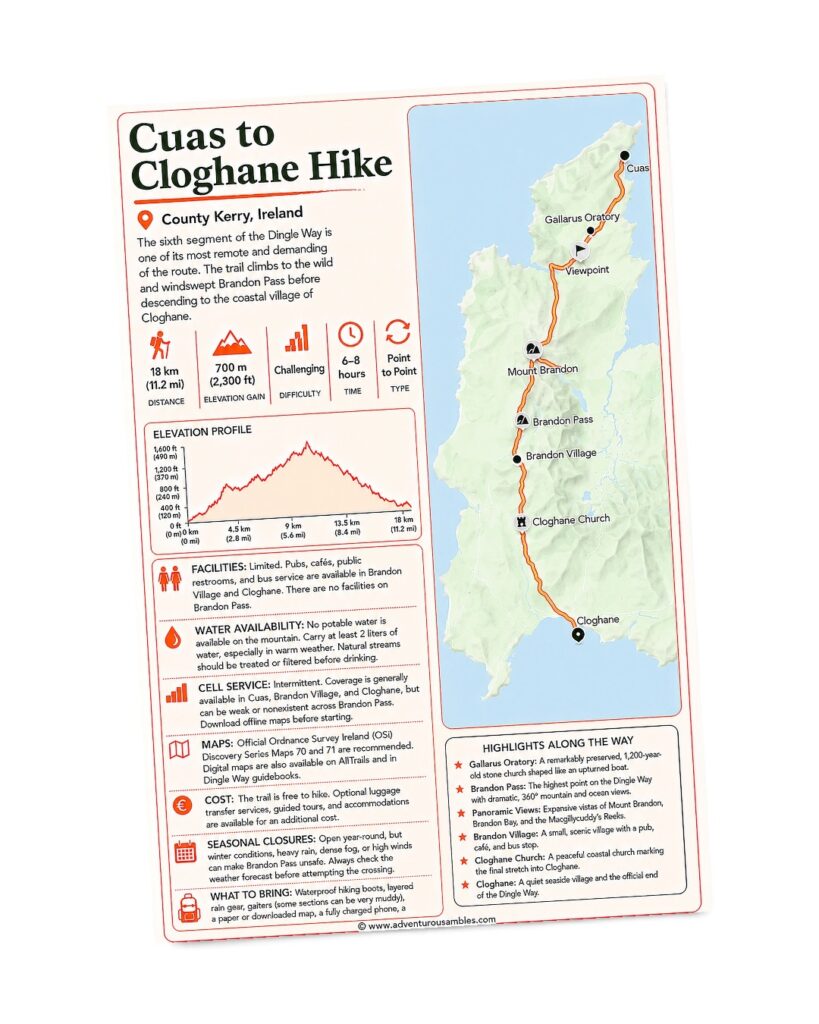
Take the mountain crossing with you.
Save this Cuas to Cloghane Hike map before tackling the Dingle Way’s most challenging stage. Follow the dramatic route over Brandon Pass, passing rugged mountain scenery and key landmarks on the journey from Cuas to Cloghane. Use this printable guide to review the route map, elevation profile, trail details, and essential planning information. Print it or save it to your phone to help you navigate the crossing safely and confidently.
Some days on the Dingle Way were defined by views that stole the show. On other days, the landscape simply asked us to trust it.
Our hike from Cuas over Brandon Pass toward Brandon Village and Cloghane was one of those days.
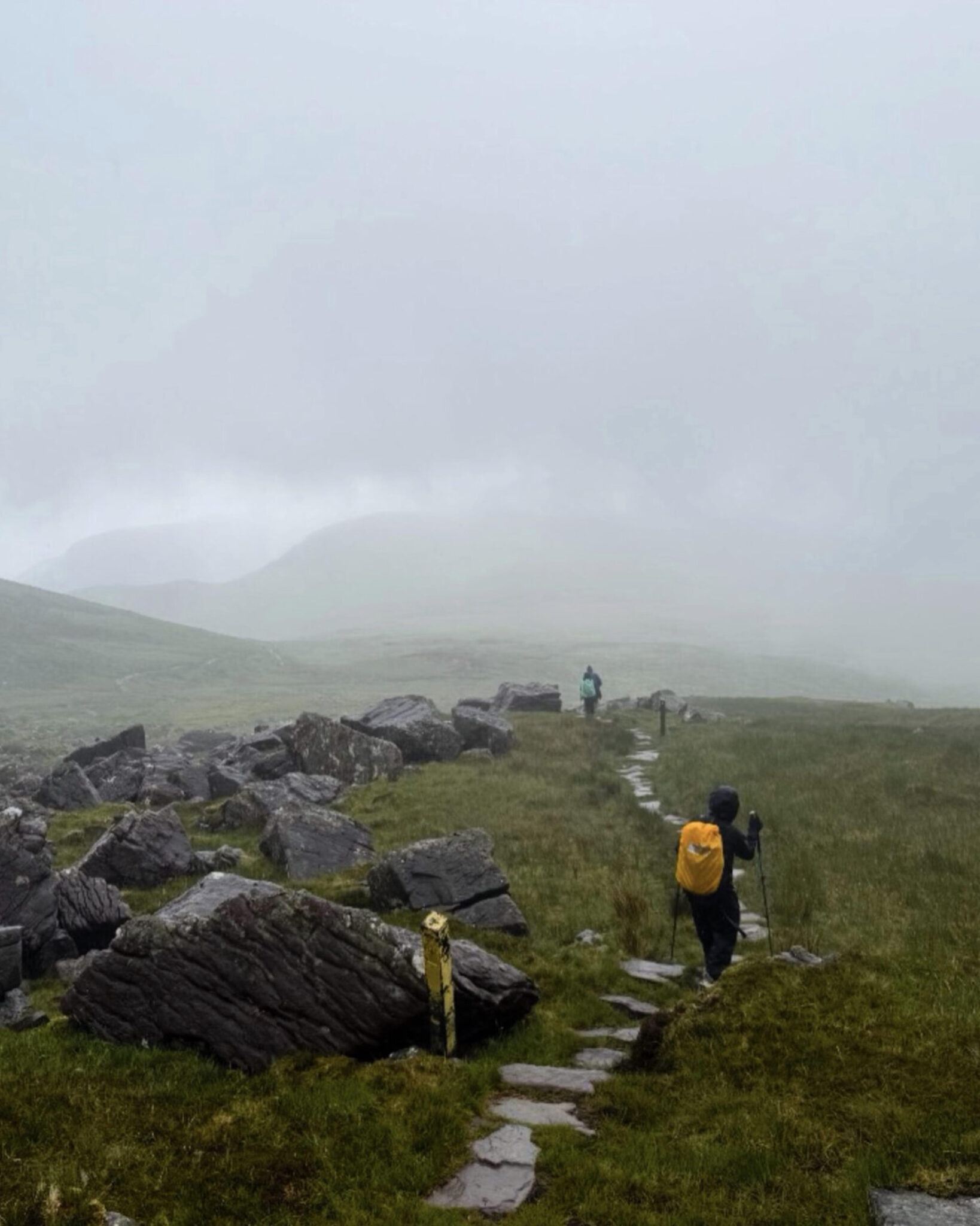
It became the most physically demanding stage of our journey, but it was also one of the most exhilarating. Rain swept across the mountainside, strong winds tested every step, and thick fog concealed nearly everything beyond a few dozen yards. Yet the mystery of the day became its greatest reward. Instead of admiring distant panoramas, we found ourselves immersed in the landscape, feeling every gust of wind, every rain-soaked stone beneath our boots, and every quiet moment shared with fellow hikers making the same pilgrimage.
By the end of the day, we were tired, soaked, and smiling beside a crackling fire in Brandon Village. We could not have imagined a more fitting conclusion to our Dingle Way adventure.
THE CLIMB BEGINS
Leaving Cuas for
Brandon Pass
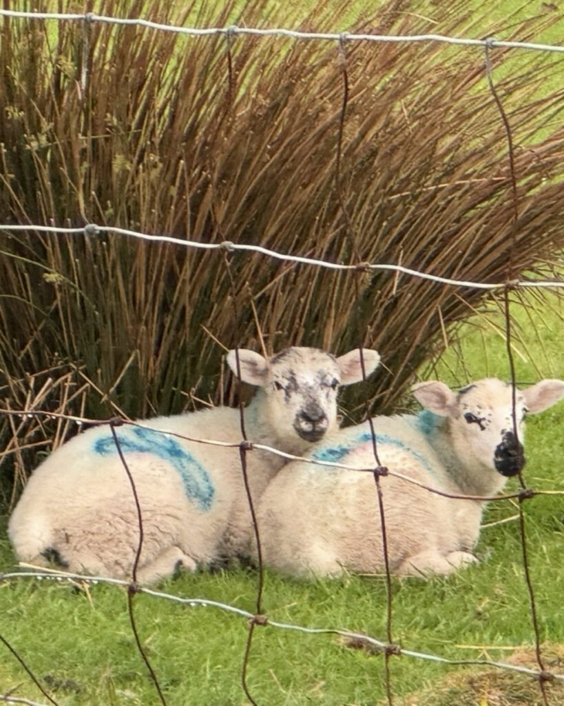
The day begins gently enough as quiet country lanes wind toward the broad shoulders of Mount Brandon. Stone walls divide emerald-green fields where flocks of sheep graze peacefully, seemingly unaffected by the changing weather. Curious lambs watched us pass from behind old wire fences while tufts of rushes and grasses bent in the breeze.
As we climbed higher, everything around us grew quieter.
Soon, the roads gave way to old green lanes and then to rough mountain paths that crossed open moorland. Heather, moss, and thick blankets of peat covered the hillsides, broken only by scattered boulders polished smooth by centuries of wind and rain.
Although the climb toward Brandon Pass was steady rather than technical, the conditions quickly became our greatest challenge. As the mountains disappeared into the clouds, our visibility narrowed until we could see little more than the next trail marker.
FOLLOWING AN ANCIENT ROUTE
Crossing the Pilgrims’
Path
For centuries, pilgrims have crossed Brandon Pass on their way toward Ireland’s second-highest mountain. As we walked through the mist, we easily understood why this landscape has inspired spiritual journeys for generations.
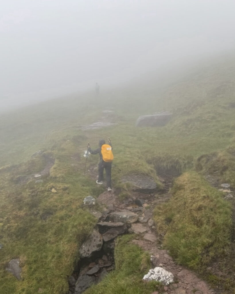
The trail led us over slick stone steps and muddy bog crossings, where every foot placement demanded our attention. In places, water flowed directly down the path and transformed sections of the trail into shallow streams. Our trekking poles became indispensable as we negotiated wet rocks and uneven ground.
A MONUMENT IN THE MIST
The Arraglen
Ogham Stone
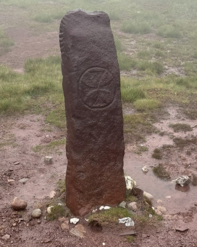
Within that thick mist, we encountered one of the route’s most significant historical landmarks: the Arraglen Ogham Stone.
Carved more than a thousand years ago and later inscribed with a Christian cross, the stone represents the meeting of ancient Ireland’s pagan traditions and its early Christian heritage. When it emerged from the fog, we felt almost as though the monument had been waiting for us all along.
Reaching the pass gave us an enormous sense of accomplishment; not because we were rewarded with sweeping mountain views, which we never saw, but because we had earned the crossing despite the conditions.
Nearby, simple cairns and weathered trail markers pointed us onward. They also reminded us that countless walkers had crossed this same mountain long before us.
Although the clouds concealed the famous views of Brandon Bay and the Atlantic, they encouraged us to notice details we might otherwise have overlooked.
Tiny mountain streams spilled across the trail, and velvety cushions of moss covered the rocks. Lichens painted the boulders in pale shades of green, white, and orange, while every depression in the hillside became a miniature wetland filled with sedges and peat-loving plants. Around us, the saturated earth released the unmistakable scent of wet heather and bog.
Every so often, the clouds lifted just enough to reveal rolling green valleys below before closing around us again. Because those glimpses were so brief, each opening felt like a gift.
CAREFUL STEPS DOWNWARD
The Long Descent
If the climb demanded our endurance, the descent required our patience.
The steep upper slopes remained slick, and muddy sections made careful footing essential. Once again, our trekking poles proved invaluable as we navigated loose stones and waterlogged ground.
Gradually, the rough mountain path transitioned to beautifully laid stone steps that eased our descent into the valley. As we lost elevation, visibility slowly improved. The outline of Mount Brandon reappeared, rocky hillsides gave way to open pastures, and the landscape eventually softened into quiet farmland once more.
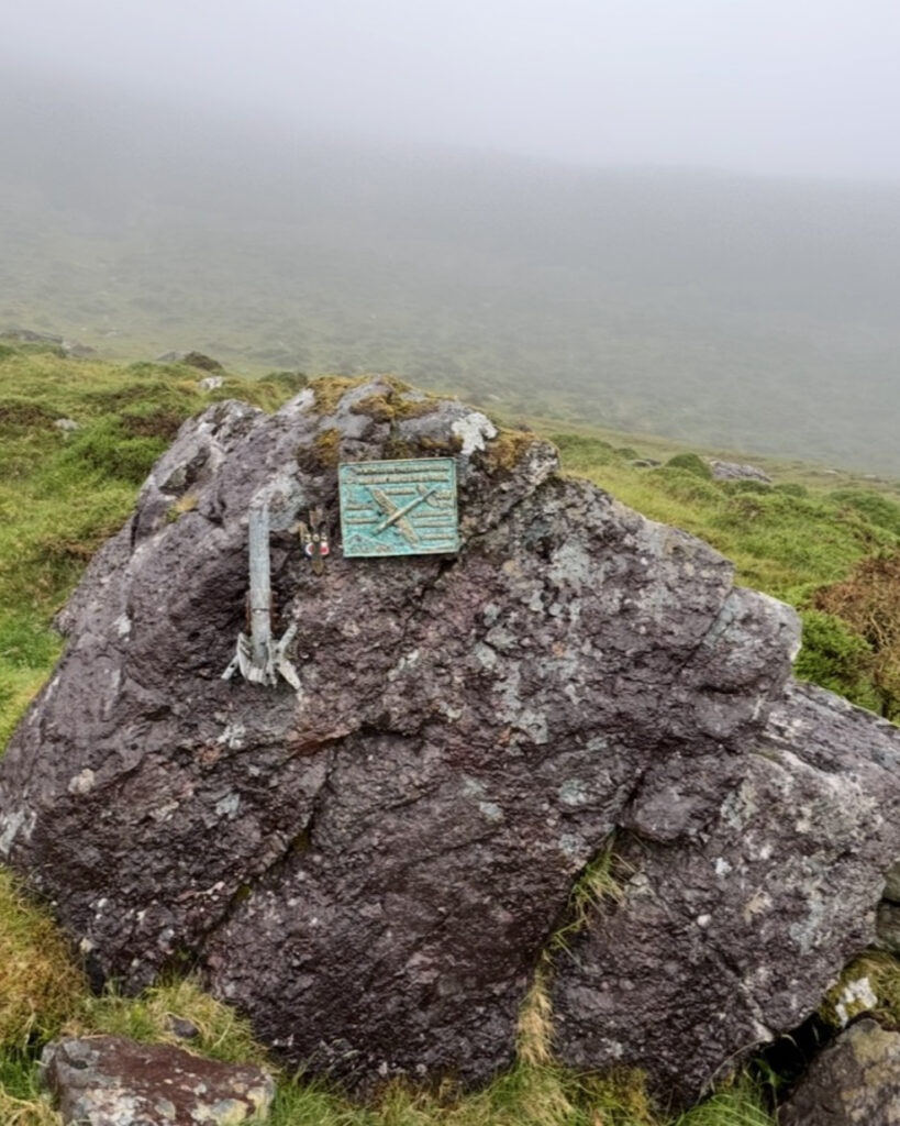
Along the way, we paused at a moving memorial dedicated to a Polish RAF bomber crew who lost their lives there during the Second World War. It reminded us that these mountains hold stories extending far beyond the ancient pilgrim route.
By the time the final stone steps gave way to quiet country lanes, the hardest part of our day was behind us. With the mountains slowly fading into the clouds at our backs, we continued toward the welcome sight of Brandon Village.
WARMTH AT THE JOURNEY’S END
Brandon Village
and an Unexpected
Act of Kindness
Originally, we intended to continue another five kilometers along quiet country lanes to Cloghane to complete the official stage. However, nature had other plans.
By the time we reached Brandon Village, we were thoroughly soaked despite wearing full rain gear. As we walked past a row of homes wondering aloud how much farther we had to go, the top half of a Dutch door swung open. A friendly local named Marguerite introduced herself.
Seeing just how drenched we were, she smiled and suggested something we hadn’t even considered. “Why don’t you warm yourselves by the fire at Murphy’s Pub? The bus stops right outside.”
It was exactly the advice we needed.
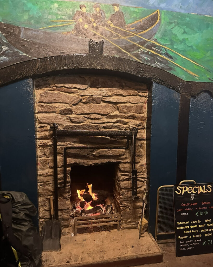
Instead of pushing through simply to finish, we embraced the slower pace of Irish hospitality. We settled beside the glowing fire with steaming hot toddies and a hearty meal while the rain continued to fall outside. We laughed as the staff patiently mopped up the puddles collecting around our boots and rain gear, joking that it was simply part of welcoming hikers off Brandon Pass. The owner kindly offered to put our soaked jackets in the dryer, and before long we were wrapped in warm, dry layers once again.
As the afternoon stretched on, we found ourselves joining the locals gathered around the television to watch a soccer match. Although we had arrived as weary hikers seeking shelter from the storm, we left feeling as though we had spent the afternoon among friends.
The warmth of the pub, the generosity of Marguerite, the kindness of the staff, and the easy camaraderie of the people in Brandon Village made for one of the most special afternoons of our entire trip.
Sometimes the best travel memories aren’t found at the summit. They’re found beside a crackling fireplace, laughing with strangers who quickly become friends after you’ve earned every step of the journey.
WHAT TO KNOW BEFORE CROSSING
Trail Notes
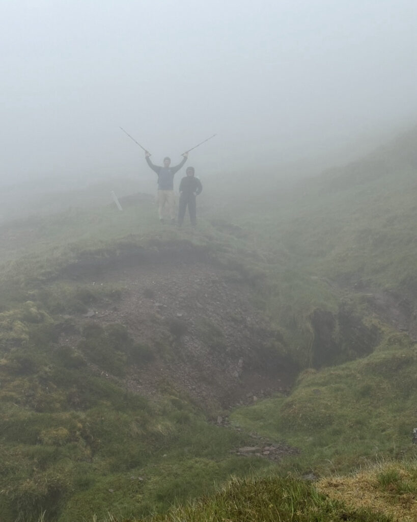
Our experience showed us why this stage is widely considered one of the Dingle Way’s most challenging sections. Conditions on Brandon Pass can change quickly, and heavy rain, dense fog, and strong winds can dramatically reduce visibility. Saturated ground can also make both the ascent and descent considerably more difficult.
Because we encountered slick stone steps, muddy bog crossings, and waterlogged paths, our trekking poles proved invaluable. We would also recommend waterproof boots with good grip, full rain gear, and warm layers—even when the forecast appears favorable.
Navigation deserves careful attention as well. At times, the fog allowed us to see little more than the next trail marker, so carrying an offline map or GPS track can provide useful reassurance when visibility deteriorates.
In clear conditions, the pass offers sweeping views of Brandon Bay, Mount Brandon, and the Atlantic. We never saw those famous panoramas, but the clouds gave us something equally memorable: the rare experience of walking through Ireland’s mountains completely wrapped in mist.
A JOURNEY DEFINED BY MORE THAN VIEWS
Final Thoughts
Every long-distance trail has a stage that becomes one of its defining memories. For us, that stage was Brandon Pass.
It was not memorable because it offered us the grandest views—we never saw them—but because it reminded us that the most meaningful journeys are not measured by perfect weather or completed mileage. Instead, we remember the perseverance they require, the unexpected kindness we encounter, and the people who share the path with us.
Although we never reached Cloghane that afternoon, we found a fitting conclusion to our journey beside a crackling fire in Brandon Village. In doing so, we discovered that a pilgrimage is not only about crossing mountains. Sometimes, it is also about recognizing when plans need to change and accepting hospitality when we need it most.
Looking back, we would not change a thing.
As we boarded the bus that evening, we realized the Dingle Way had given us far more than spectacular scenery.
It had introduced us to the landscapes, history, and generosity that make Ireland truly unforgettable.
“The only kinds of wealth worth speaking of were the fruits of the earth.”
Thomas Cahill, How the Irish Saved Civilization
THOUGHTFULLY RESEARCHED
Written by Jacqueline Miller, founder of Adventurous Ambles. Through firsthand travel, original photography, and detailed route research, Jacqueline creates walking guides, hiking resources, destination reading lists, and travel inspiration for curious travelers. Unless otherwise noted, all content and photography on Adventurous Ambles are original works protected by copyright.
KEEP WANDERING
More Adventurous Ambles in Ireland
DESTINATION GUIDE

READING LIST
FREE WALKING TOUR

RESTAURANT RECOMMENDATION
HIKING GUIDE
DESTINATION HIKING GUIDE
HIKING GUIDE
HIKING GUIDE
HIKING GUIDE
Dingle Way: Dunquin to Cuas
Dunquin to Cuas, County Kerry, Ireland, Europe
15 miles, 8 hours, Moderate
FREE WALKING TOUR