TAKE THE TRAIL TO THE HARBOR
Dingle Way:
Annascaul to
Dingle
Cross rolling countryside, pass the ruins of Minard Castle, and finish beside
the colorful harbor in Dingle.
Castles,
Coastal Views,
and an Unforgettable
First Day on
the Dingle Way
Trail at a Glance
TIME
6-8 hours
Approximate
DIFFICULTY
Moderate to hard
varies by terrain & weather
DISTANCE
22-23 km (13.5-14.2 miles)
Point to point
ELEVATION
~340-400 meters (1115-1300 ft)
Approximate
Quick Trail Notes
Location
County Kerry, starting in Annascaul village and ending in Dingle, Ireland.
The route includes rough tracks, muddy moorland, sandy beaches, fields, and rural roads. It is not wheelchair accessible or suitable for standard strollers.
Facilities
Public restrooms, pubs, cafés, and accommodations are available in both Annascaul and Dingle. For the only indoor restroom along the route, take a short detour into Lispole mid-way to use the customer facilities at the local petrol station.
Water Availability
Potable water is available in the villages at either end of the trail. Carry enough water for the hike, as refill opportunities are limited along the route.
Cell Service
Generally good along the main roads and higher elevations, but can be spotty or drop out in deep coastal valleys and on mountain paths.
Dogs
Not recommended. Much of the trail crosses active farmland where dogs are either prohibited or may disturb livestock.
Maps
Official Ordnance Survey Ireland (OSi) Discovery Series Maps 70 and 71 are recommended. Digital maps are also available on AllTrails and in Dingle Way guidebooks.
Best Time to Hike
April through September offers the longest days and generally the best weather, although the trail is open year-round.
The trail is free to hike. Optional luggage transfer services, guided tours, and accommodations are available for an additional cost.
What to Bring
Waterproof hiking boots, layered rain gear, gaiters (some sections can be very muddy), a paper or downloaded map, a fully charged phone, a power bank, a small first aid kit, a packed lunch, and plenty of drinking water.
Read Along the Route
McCarthy’s Bar by Pete McCarthy is a humorous and heartfelt journey through rural Ireland that perfectly complements the friendly locals, traditional pubs, and unforgettable landscapes you’ll experience on the walk from Annascaul to Dingle.
FREE PRINTABLE GUIDE
Take the scenic trail with you.
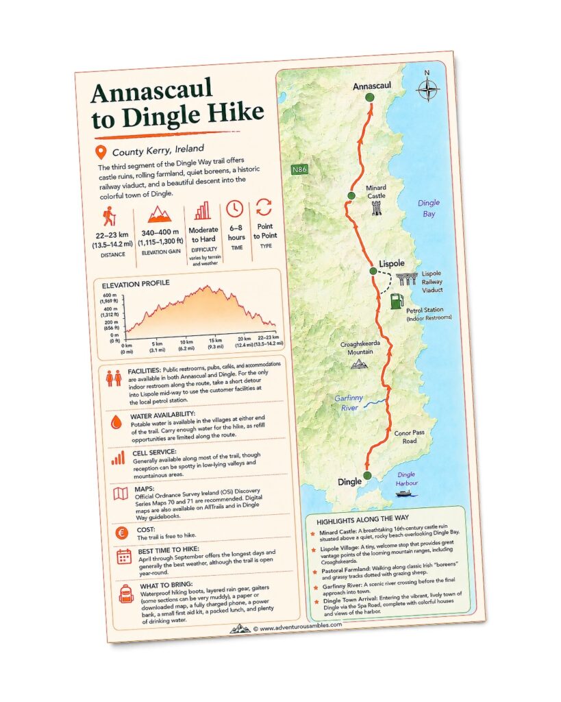
Save or print this Annascaul to Dingle trail map before your hike. Follow one of the Dingle Way’s most scenic stages through peaceful countryside, historic landscapes, and sweeping views on the journey toward colorful Dingle. Use this printable guide to review key trail statistics, the elevation profile, detailed route map, hiking highlights, and practical information about facilities, water availability, navigation, and what to bring before setting out.
Our first day on the Dingle Way began beneath clear blue skies, a welcome rarity on Ireland’s west coast.
Before the day was over, we’d stand beneath the ruins of a 16th-century castle, climb over ancient stone walls, meet a friendly sheep farmer and his loyal border collie, and celebrate with a well-earned pint in colorful Dingle. It was the perfect introduction to one of Ireland’s most celebrated long-distance trails.
Although approximately 70% of this stage follows quiet country roads, the constantly changing scenery made every mile worthwhile. Peaceful farmland, dramatic coastal vistas, historic landmarks, and warm encounters with the locals combined to create a day we’ll never forget
FROM VILLAGE TO CASTLE
Rolling Countryside &
the Road to Minard Castle
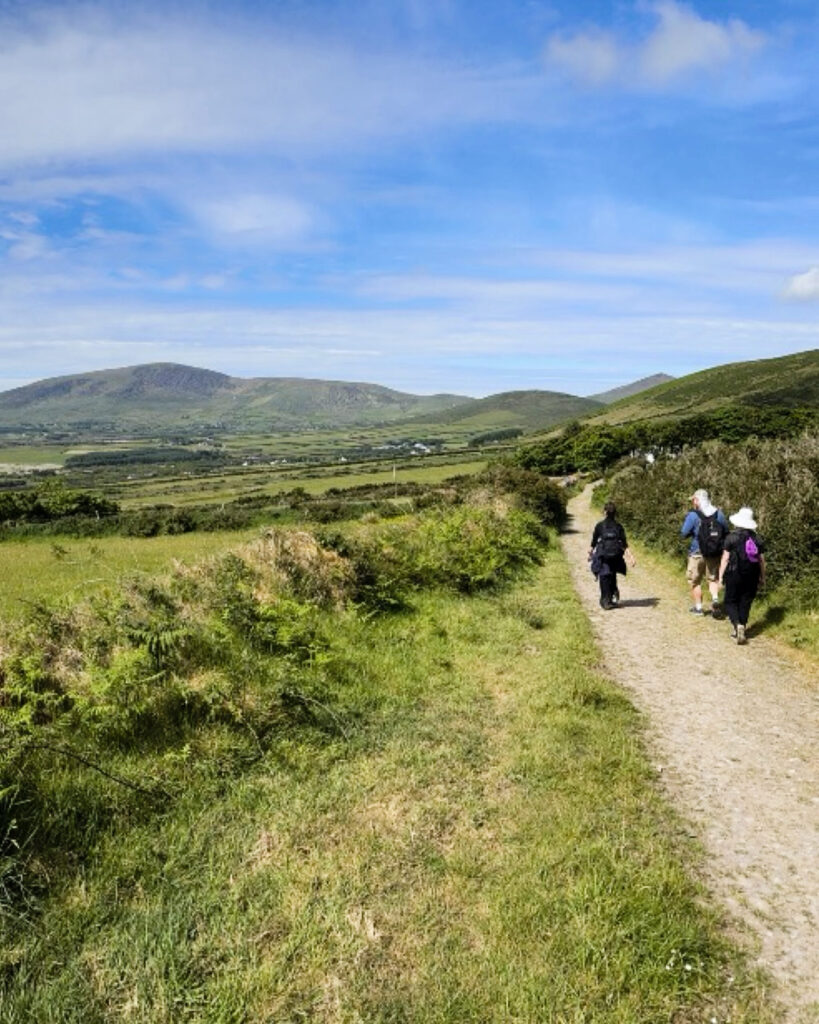
Departing Annascaul, the Dingle Way briefly joins the busy Tralee–Dingle (N86) road before turning onto much quieter country lanes. For the next four to five kilometers, the route gently descends through rolling farmland toward the magnificent ruins of 16th-century Minard Castle. Although this section is paved, the peaceful boreens, grazing sheep, and ever-expanding coastal views made for a beautiful start to our journey.
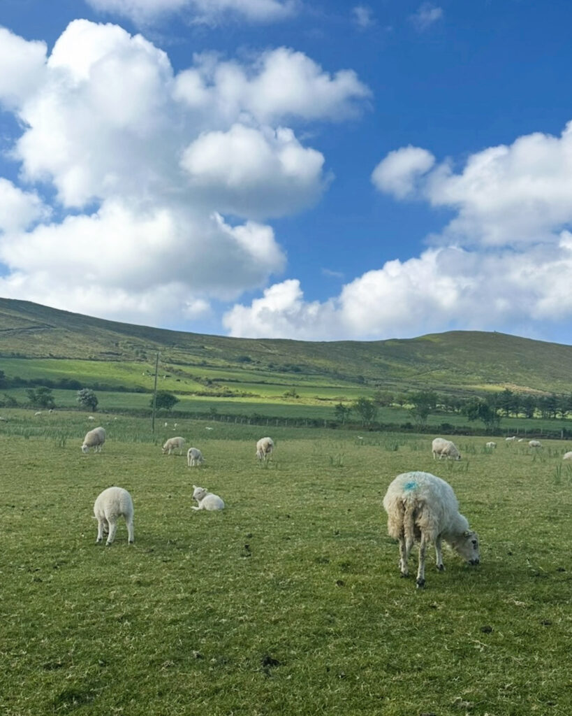
The countryside was bursting with the sights and sounds of spring. The distant bleating of sheep became the soundtrack to our morning as flocks grazed peacefully across the hillsides. Many wore bright pink markings, making it easy for farmers to identify them from afar. Along the roadside, hedgerows overflowed with towering purple foxgloves, blooming hawthorn, brilliant yellow gorse, brambles, lush ferns, and wild grasses that added splashes of color to every bend in the road.
Perched dramatically above a rocky shoreline, Minard Castle is one of the most spectacular viewpoints on the entire trail. The quiet beach below is the perfect place to pause, catch your breath, and admire sweeping views across Dingle Bay toward the mountains of the Iveragh Peninsula. The contrast between the weathered stone tower, the deep blue Atlantic, and the surrounding emerald hills creates one of those landscapes that almost doesn’t seem real.
We found ourselves lingering longer than planned, taking photos from every angle while enjoying the warm sunshine and watching fellow hikers explore the rocky shoreline below.
INTO RURAL IRELAND
Quiet Boreens Through
Working Farmland
Leaving Minard Castle behind, the trail changes character with a short but steep climb away from the beach before returning to a network of quiet boreens and minor roads that weave through working farms toward the village of Lispole.
Although this stage involves a majority of road walking, traffic was surprisingly light. Many of the narrow roads have little or no shoulder, so we stayed alert and listened for the occasional passing car.
The scenery quickly made us forget we were walking on pavement. Rolling green hills stretched in every direction, dotted with farmhouses, ivy-covered cottages, and neatly divided fields that have been worked for generations. Curious black-and-white dairy cows often paused their grazing long enough to watch us pass before returning to the rich pasture, while bees drifted lazily from flower to flower among the colorful hedgerows.
One of our favorite moments wasn’t a famous landmark at all. As we continued through the countryside, we met a friendly sheep farmer making his daily rounds on a bright red quad bike. Riding calmly on the front platform was his loyal black-and-white border collie, patiently accompanying him from field to field. We stopped to chat for a few minutes about the beautiful weather, the trail, and life on the Dingle Peninsula. Encounters like these are one of the reasons we love long-distance walking. They offer genuine connections with the people who know these landscapes best.
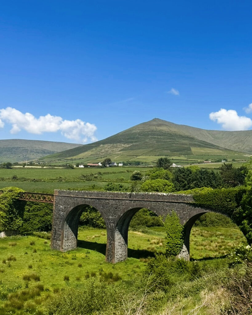
As we approached the small village of Lispole, another reminder of the peninsula’s rich history came into view. Rising gracefully above the surrounding fields, the ivy-clad stone arches of the former Lispole railway viaduct once carried trains across the peninsula, connecting rural communities long before the Dingle Way existed. Today, the beautifully preserved structure blends seamlessly into the landscape, standing as a quiet reminder of Ireland’s railway past. We paused for a few photos before continuing on, imagining steam trains crossing the arches where hikers now pass below.
OFF THE PAVEMENT
Crossing Fields the Irish Way
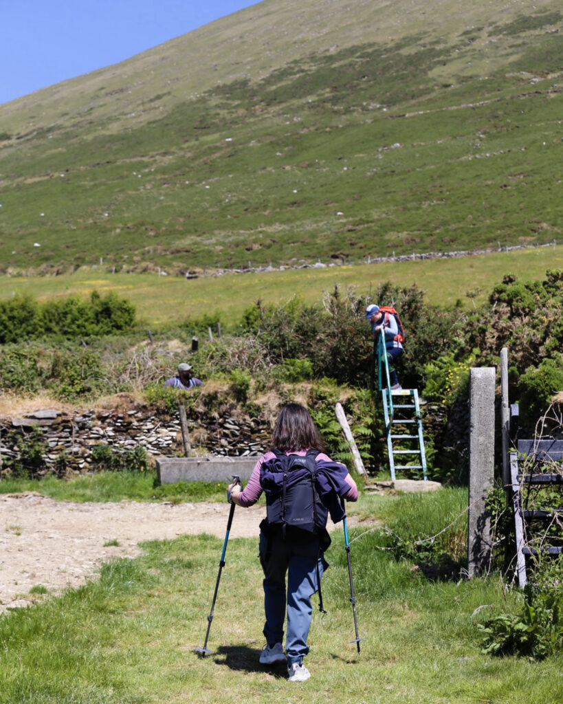
Beyond Lispole, the character of the trail changed once again. After crossing the N86 and following another quiet country road for a couple of kilometers, the Dingle Way finally left the pavement behind. The route climbed onto the open slopes of Croaghskearda Mountain, where grassy tracks crossed working farmland and the terrain became noticeably rougher underfoot.
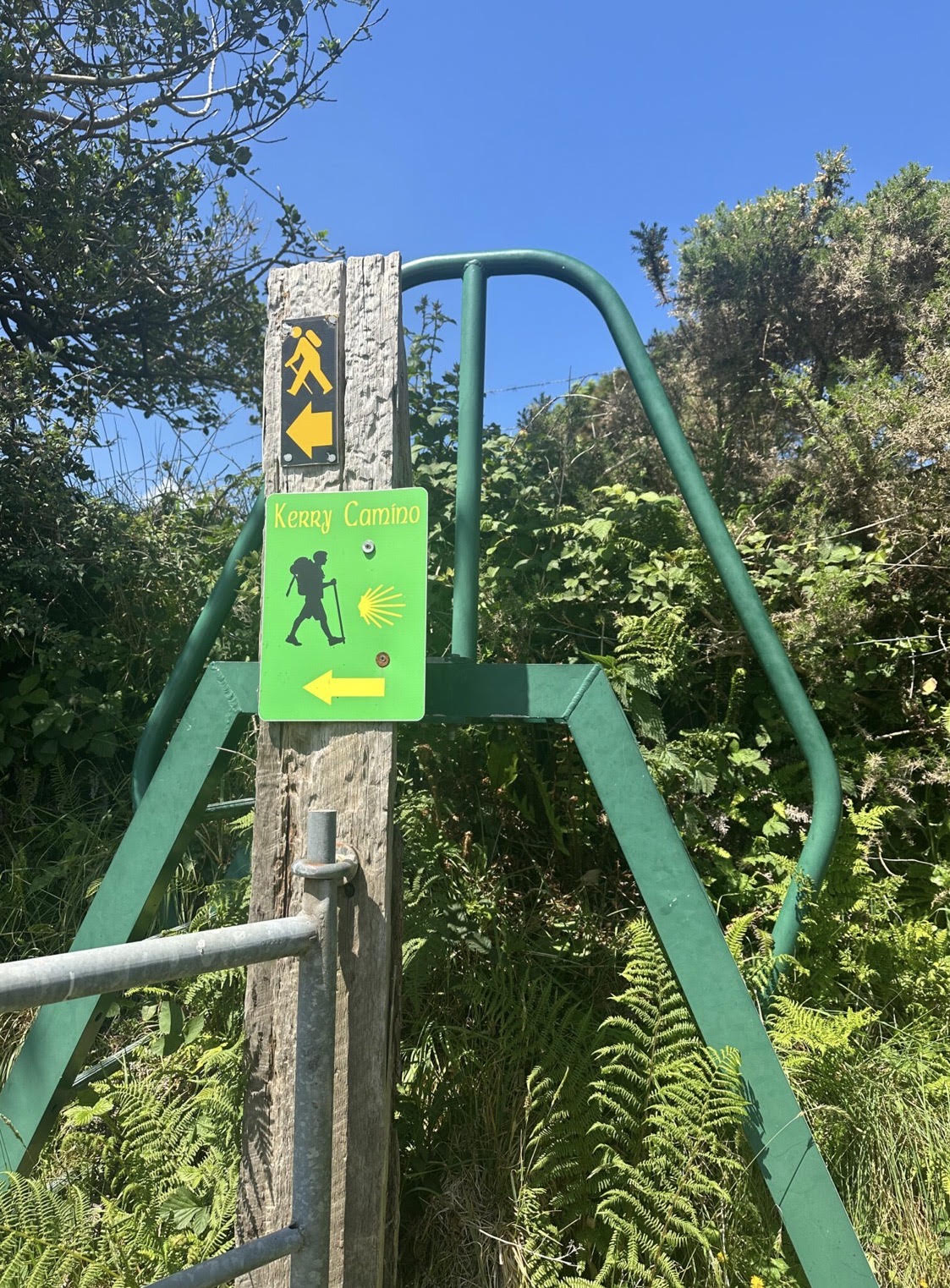
Throughout the day, we climbed over sturdy metal stile ladders built into fences and ancient stone walls. These clever crossings allow hikers to move easily from one field to the next while keeping livestock safely contained. Walking through active pasture also meant carefully watching our footing, not only for the uneven ground, but also for the occasional sheep and cow droppings left along the trail. It’s all part of hiking through Ireland’s working countryside.
Depending on recent rainfall, this off-road stretch can become quite muddy and mucky, so waterproof hiking boots are highly recommended. Fortunately, the dry weather made for excellent walking during our visit.
The landscape felt wonderfully timeless. Dry-stone walls climbed the hillsides much as they have for centuries, while swallows swooped effortlessly overhead, catching insects in the warm afternoon air. Every stile revealed another panorama of emerald hills, distant mountains, and occasional glimpses of the sparkling Atlantic.
THE HOME STRETCH & TRAIL’S END
The Final Walk into Colorful Dingle
As the mountain slopes gradually gave way to the valley below, we crossed the Garfinny River before rejoining a quiet paved road beneath the famous Conor Pass for the final four kilometers into Dingle. The steady downhill walk made for a relaxing finish after a varied day of climbing hills, crossing farmland, and following peaceful boreens.
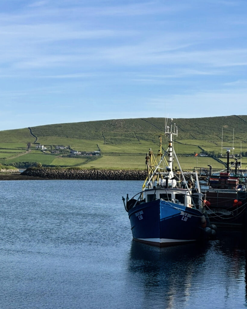
Soon colorful buildings appeared in the distance. Fishing boats bobbed gently in the harbor, and the lively energy of Dingle replaced the peaceful solitude of the countryside. After a full day on the trail, the gradual descent into town felt like the perfect reward.
Few towns offer a more rewarding finish to a day of hiking than Dingle.
Brightly painted buildings in shades of blue, pink, yellow, and green line the narrow streets and bustling waterfront. Flower-filled window boxes brighten historic storefronts, while cafés, bookstores, seafood restaurants, and traditional pubs invite hikers to slow down and linger. Fishing boats bob gently in the harbor, and the sound of live music drifts from open pub doors, creating the warm, welcoming atmosphere for which Dingle is known.
After checking into our accommodations, we celebrated our first day on the trail with a hearty Irish meal and a well-earned pint at a local pub. It was the perfect way to end a day filled with unforgettable scenery and new experiences.
LOOKING BACK
Final Thoughts
Our first day on the Dingle Way was everything we had hoped it would be and more. Every few kilometers revealed something different, from the dramatic ruins of Minard Castle and the rolling green hillsides to the quiet boreens, mountain pastures, and colorful wildflowers that lined the trail.
What we’ll remember most, though, are the moments that couldn’t be found on a map. Chatting with a warm local and his dog, crossing centuries-old stone walls into active pastures, and taking time to simply admire the views made this stage feel about more than reaching Dingle. It was about experiencing the rhythm of life on the Dingle Peninsula.
If this first day was any indication of what lay ahead, we knew the Dingle Way was going to be every bit as memorable as we’d imagined.
“If life is a book, then read it while you can.”
Pete McCarthy, McCarthy’s Bar
THOUGHTFULLY RESEARCHED
Written by Jacqueline Miller, founder of Adventurous Ambles. Through firsthand travel, original photography, and detailed route research, Jacqueline creates walking guides, hiking resources, destination reading lists, and travel inspiration for curious travelers. Unless otherwise noted, all content and photography on Adventurous Ambles are original works protected by copyright.
KEEP WANDERING
More Adventurous Ambles in Ireland
DESTINATION GUIDE

READING LIST

FREE WALKING TOUR

RESTAURANT RECOMMENDATION
HIKING GUIDE
DESTINATION HIKING GUIDE
HIKING GUIDE
HIKING GUIDE
Dingle Way: Dunquin to Cuas
Dunquin to Cuas, County Kerry, Ireland, Europe
15 miles, 8 hours, Moderate
HIKING GUIDE
Dingle Way: Cuas to Cloghane
Cuas to Cloghane, County Kerry, Ireland, Europe
11 miles, 8 hours, Challenging

FREE WALKING TOUR