Columbia River Gorge Walks & Hikes Trail Guide

Four Gorge Trails, From Gentle Walks to Waterfall Climbs

01   |   A SHORT WALK TO A DRAMATIC WATERFALL
Bridal Veil Falls

TIME

45 minutes

DIFFICULTY

Easy

DISTANCE

0.6 miles out & back

ELEVATION

~70–120 feet
02   |   TWO WATERFALLS WITH A STEADY CLIMB
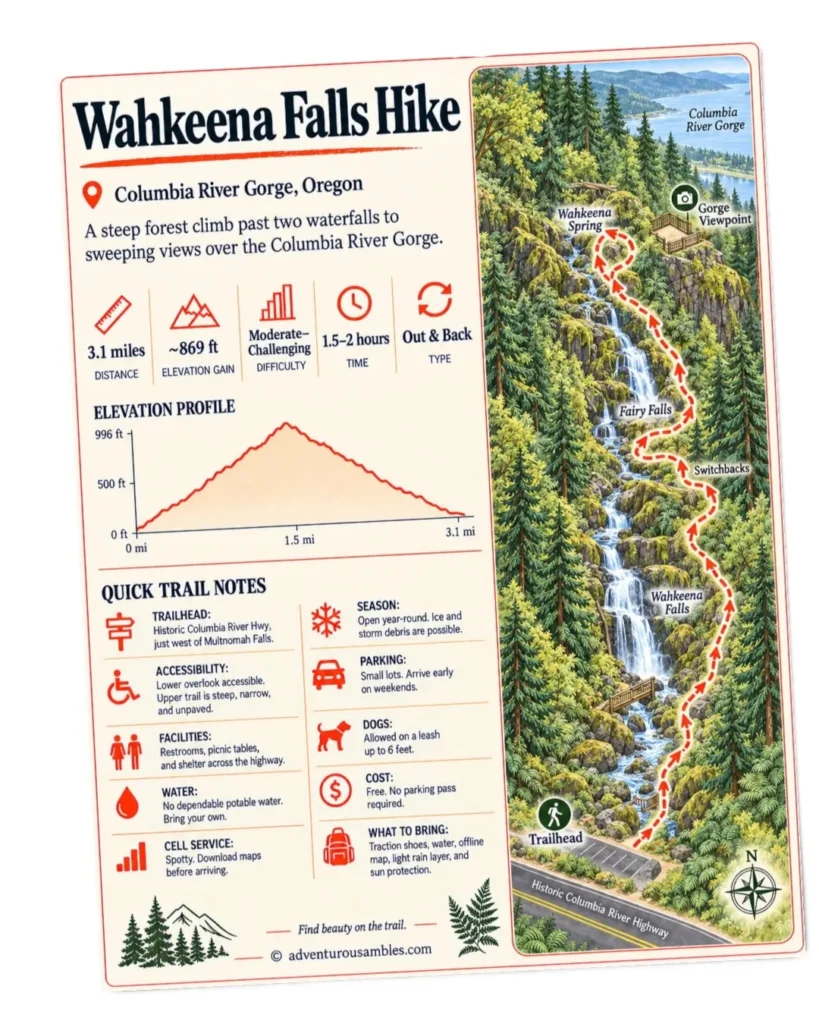
Wahkeena Falls

TIME

1.5–2 hours

DIFFICULTY

Moderate–Challenging

DISTANCE

3.1 miles out & back

ELEVATION

~869 feet

03   |   A FLAT, FAMILY-FRIENDLY HATCHERY LOOP
Bonneville Fish Hatchery

TIME

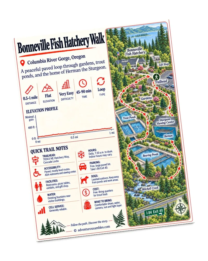
45–90 minutes

DIFFICULTY

Very Easy

DISTANCE

0.5–1 mile loop

ELEVATION

Minimal gain
04   |   OREGON’S TALLEST WATERFALL FROM BELOW AND ABOVE
Multnomah Falls

TIME

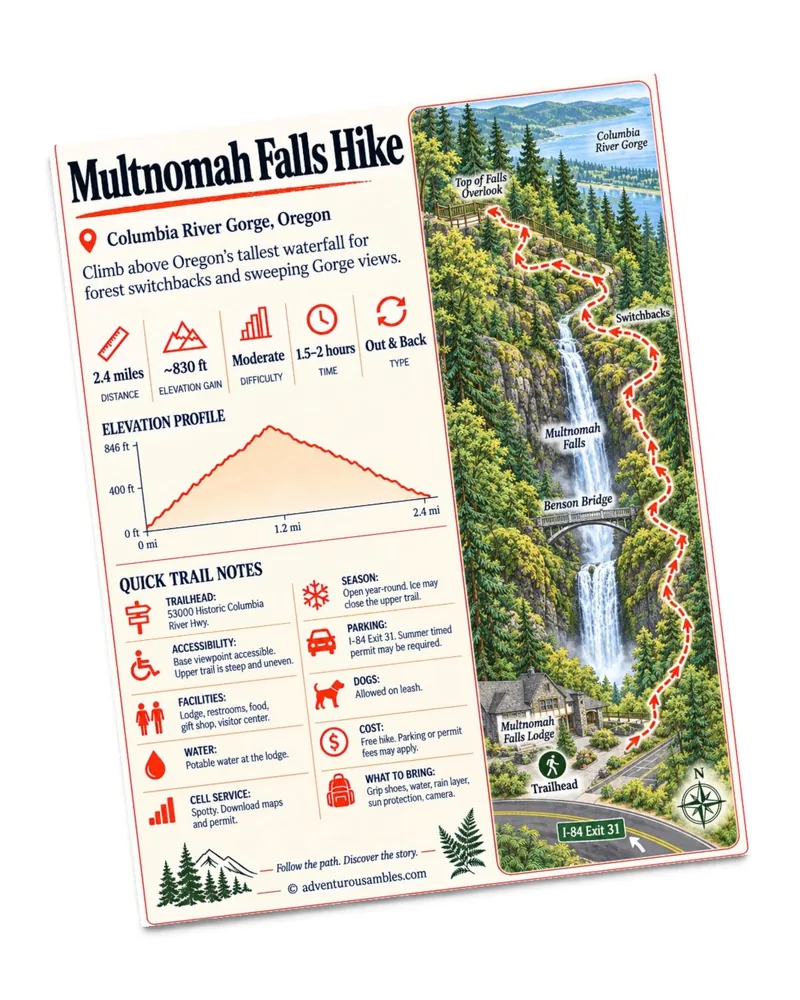
1.5–2 hours

DIFFICULTY

Moderate

DISTANCE

2.4 miles out & back

ELEVATION

~830 feet

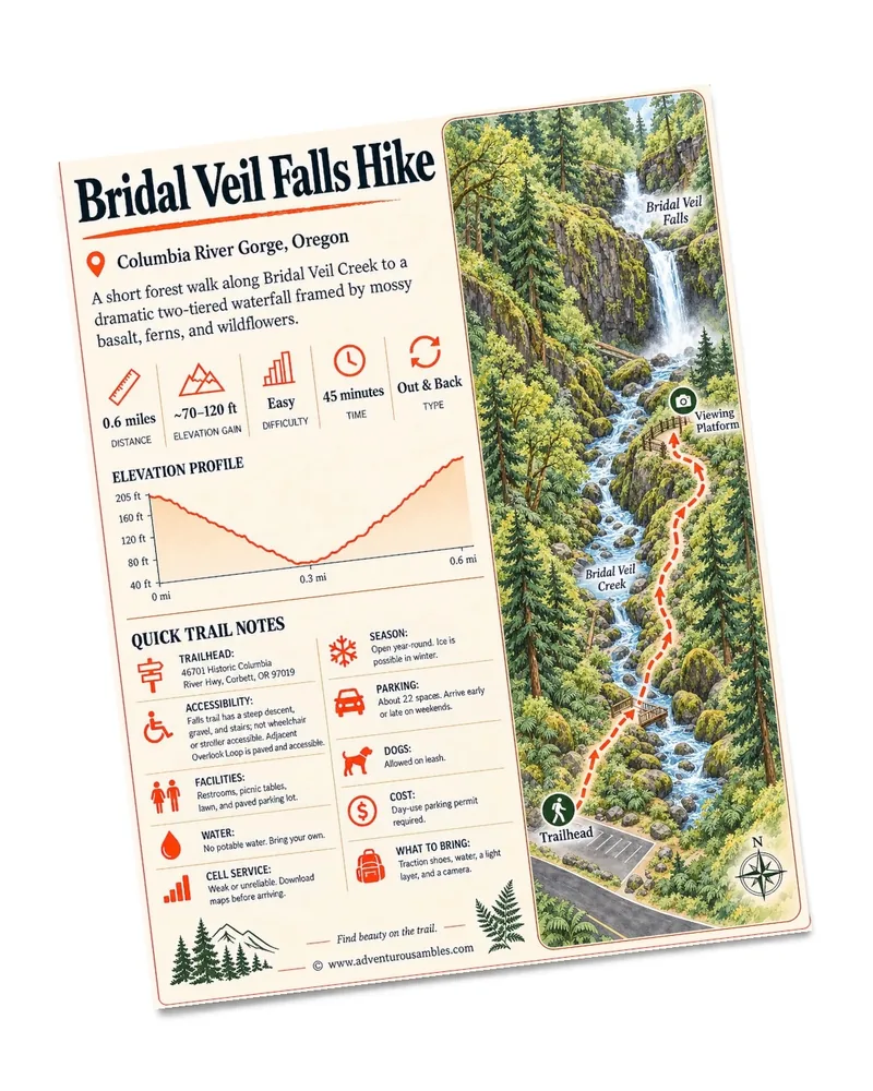
01  |  Bridal Veil Falls Hike

HIKING GUIDE

Follow the Creek
to a Waterfall
Hidden in the Forest

Trail at a Glance

TIME

45 Minutes
To spend time on the viewing platform

DIFFICULTY

Easy

Short & mostly paved

DISTANCE

0.6 Miles
Out & Back

ELEVATION

~70-120 Feet
Approximate gain
bridal veil falls

Quick Trail Notes

Trailhead
Accessibility

The trail to the waterfall base is not wheelchair or stroller accessible due to the steep descent, gravel surface, and stairs. However, the adjacent upper Overlook Loop Trail is fully paved, flat, and ADA-accessible.

Facilities

The park trailhead features vault restrooms, picnic tables, a large lawn area, and a paved parking lot.

Water Availability

No potable drinking water is available at the trailhead. Be sure to pack your own.

Cell Service

Coverage can be weak or unreliable in this part of the Gorge. Download directions or a trail map before arriving.

Seasonal Closures

Open year-round. The trail may become icy and slick during severe winter storms, but the waterfall flows beautifully in all seasons.

Parking

The paved lot has approximately 22 spaces and can fill quickly on weekends. Arriving early in the morning or later in the afternoon gives a better chance of finding a spot.

Dogs

Allowed on leash

Maps

Available via AllTrails and On X Backcountry App

Cost

A day-use parking permit is required. Current daily rates are $10 for Oregon residents and $12 for out-of-state visitors. Twelve-month permits are $60 and $75, respectively.

What to Bring:

Shoes with reliable traction, water, a light layer for the shaded canyon, and a camera. The rocks and stairs can remain damp even on sunny days.

Read Along the Route

Read The Bridge of the Gods by Frederic Homer Balch alongside this hike. Set amid the Columbia River Gorge, this historical romance weaves regional folklore, adventure, and dramatic landscapes into a story that adds another layer of meaning to Bridal Veil Falls and the surrounding Gorge. It is a natural companion for exploring a place where mossy forests, basalt cliffs, and rushing water already feel steeped in legend.

FREE PRINTABLE GUIDE

Take the creekside walk with you.

Print or save this Bridal Veil Falls hiking map for a short, scenic walk through lush forest to the two-tiered waterfall. Use it to preview the route, elevation changes, viewing platform, parking details, and other helpful trail information.

Bridal Veil Falls is the kind of hike that is perfect for slipping into a day along the Historic Columbia River Highway: short enough to feel spontaneous, but beautiful enough to become one of the day’s highlights.

From the parking lot, we followed the sign toward the falls and almost immediately stepped beneath a wonderfully green canopy. Sunlight filtered through bigleaf maples and tall evergreens, catching on moss-covered branches and lighting up the ferns below. Purple foxglove also grew beside the trail, adding bright splashes of color to a forest that already felt a little enchanted.

The route begins gently before descending toward Bridal Veil Creek. As we moved deeper into the canyon, the air became cooler and the sound of running water gradually replaced the noise of the highway. At the creek, clear water flowed over dark stones beneath twisting, mossy trees. It was the sort of scene that makes a short walk feel much farther removed from civilization than it really is.

From there, the trail crosses the creek and continues down through a series of switchbacks and stairs. The descent is brief, but we knew we would feel it a little more on the climb back. We took our time, as the path was damp. Then the waterfall appeared through the trees.

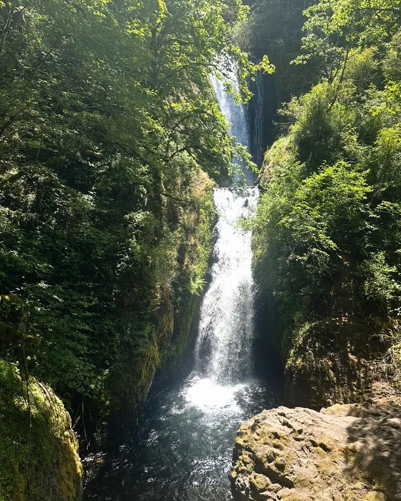
Bridal Veil Falls drops about 120 feet in two distinct tiers, tumbling beneath the historic highway bridge and through a narrow corridor of mossy basalt. From the viewing platform, we could see the upper cascade spilling into a hidden middle pool before the lower tier plunged into the dark basin below. Sunlight flashed across the water while mist drifted into the surrounding ferns and wildflowers.


For such a short hike, the view feels surprisingly dramatic. We remained at the platform, taking photos and watching the water change from silver ribbons to bright white spray as the light shifted through the trees.

The return followed the same trail uphill. It was enough of a climb to warm us up, but it was over almost too soon. If time allows, I recommend pairing the waterfall trail with the paved Overlook Loop across the parking area. Its glimpses of the Columbia River and forested Gorge make a lovely contrast to the cool, enclosed waterfall canyon.

Bridal Veil Falls may be a small hike, but it delivers everything one hopes to find on a Gorge trail: rushing water, mossy forest, colorful wildflowers, and a truly memorable view waiting at the end.
ONE PAGE AND STEP AT A TIME
“And still the river holds its course, bright, beautiful, inscrutable.”

Frederic Homer Balch, The Bridge of the Gods

02  |  Wahkeena Falls Hike

HIKING GUIDE

Climb Past Two Waterfalls
to Sweeping Gorge Views

Trail at a Glance

TIME

~1.5 to 2 hours
Roundtrip

DIFFICULTY

Moderate-Challenging
Steep with switchbacks

DISTANCE

3.1 miles

Out & Back

ELEVATION

~869 feet
Approximate gain

Quick Trail Notes

Trailhead

The trailhead sits right off the Historic Columbia River Highway, just west of Multnomah Falls. From I-84 Eastbound: Take exit 28 (Bridal Veil), go uphill on Bridal Veil Road, turn left on the Historic Columbia River Highway, and drive 2.5 miles east. From 1-84 Westbound: Take exit 35 (Ainsworth) and drive about 5 miles west on the Historic Highway. 

Accessibility

Partially accessible. The lower viewing ramp at the very base of the falls is wheelchair-accessible. However, the 3.1-mile trail climbing past this point is steep, narrow, and unpaved, making it entirely inaccessible for wheelchairs or strollers.

Facilities

Restrooms, picnic tables, and a picnic shelter are located in the day-use area across the highway from the falls. Use care when crossing the Historic Columbia River Highway.

Water Availability

There is no dependable potable drinking water at the trailhead. We recommend carrying at least one liter per person (and more on warm days).

Cell Service

Spotty to limited. Reception may be available near the highway but tends to disappear as the trail climbs into the forest. Download your route and directions in advance.

Seasonal Closures

The trail is generally open year-round, but waterfall spray can create dangerous ice during winter. Heavy rain may also contribute to slick surfaces, fallen debris, or temporary closures. Check current conditions before setting out.

Parking

A small parking area sits beside the trailhead, with additional limited parking near the picnic area across the highway. Spaces fill quickly on weekends, so an early start is helpful.

Dogs

Allowed on leash. (Maximum 6 feet).

Maps

Available via AllTrails. The trail also connects with a larger network leading toward Wahkeena Spring, Devils Rest, and Multnomah Falls, so pay attention at junctions.

Cost

Free. No recreation pass or parking fee is required at the Wahkeena Falls day-use area.

What to Bring:

Sturdy hiking shoes or trail runners with excellent traction, an offline trail map, at least one to two liters of water per person, a lightweight waterproof layer for the waterfall spray, sun protection for the more exposed viewpoints, a camera or phone as the river views and mossy Fairy Falls are especially photogenic.

Read Along the Route

Pair this hike with The River Why by David James Duncan. Beginning in Portland before heading into Oregon’s wild landscapes, the novel blends humor, philosophy, and a deep affection for rivers and the natural world. It is a fitting companion for a hike filled with rushing waterfalls, mossy forest, and sweeping views across the Columbia River.
FREE PRINTABLE GUIDE

Take the forest waterfall trail with you.

Print or save this Wahkeena Falls hiking map for the forest climb past Wahkeena Falls and Fairy Falls toward sweeping Columbia River Gorge views. The guide includes the route, elevation profile, major landmarks, and quick planning notes.

Some hikes make us wait for the payoff.

This one begins delivering almost immediately. From the Wahkeena Falls trailhead, we followed the paved path into a cool pocket of forest where ferns crowded the slopes and moss softened nearly every rock. After roughly a quarter mile, we reached the bridge below 242-foot Wahkeena Falls.

The name Wahkeena comes from a Yakama word meaning “most beautiful,” and it is hard to argue with that description. Rather than dropping in one dramatic plunge, the water tumbles and fans across the dark basalt in a series of white ribbons. The surrounding greenery makes the entire scene feel almost unreal.

We could have turned around here for a lovely half-mile outing, and plenty of visitors do, but the trail continues beyond the bridge. This is where the leisurely waterfall stroll becomes a proper hike.

The path begins climbing almost immediately, winding uphill through a tight series of switchbacks. Although much of the route is paved or covered in packed gravel, the incline is persistent. We gained nearly 900 feet over the full hike, most of it during the first half. Fortunately, the scenery gave us plenty of excuses to stop and catch our breath.

Sunlight filtered through towering Douglas firs, illuminating mossy branches and delicate cream-colored blossoms beside the trail. Through openings in the trees, we caught increasingly wide views across the Columbia River Gorge. Far below, the river appeared deep blue in the midday sun, and a tiny white sailboat drifted across the water beneath the forested hills of Washington.

The higher we climbed, the warmer and more exposed the trail became. It was an interesting contrast: cool spray and deep shade near Wahkeena Falls, followed by sunny stretches overlooking the river and steep, evergreen-covered cliffs.


About a mile from the trailhead, the sound of rushing water returned as we approached Fairy Falls. Smaller than Wahkeena but far more intimate, Fairy Falls spills in a broad, silvery fan over a wall of moss-covered basalt. Water gathers around fallen logs and dark rocks at its base before continuing down the narrow ravine.

We could walk right up to the falls, close enough to feel the cold spray on our faces. The mist was wonderfully refreshing after the switchback climb (and slightly treacherous underfoot). Rocks near the water were wet and slick, so shoes with reliable grip made a real difference.

This was our favorite stop of the hike. Wahkeena Falls is very  impressive, but Fairy Falls feels tucked away and secretive, surrounded by ferns, moss, and the constant sound of water. It is exactly the sort of place that encourages hikers to linger much longer than planned.

From Fairy Falls, we continued a little farther through the forest before turning around. The return trip was mostly downhill, with another chance to enjoy the river views before descending into the cool mist around Wahkeena Falls.

For such a short route, this hike packs in an extraordinary amount: two waterfalls, a lush Pacific Northwest forest, wildflowers, gorge cliffs, and expansive views across the Columbia River.
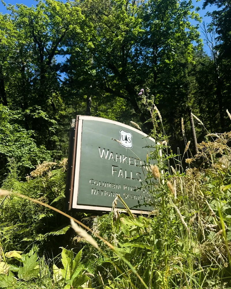


The climb is steeper than the mileage might suggest, but we thought it was well worth the effort.
ONE PAGE AND STEP AT A TIME
“All I knew was that this Earth was alive and motion was its life.”

David James Duncan, The River Why

03  |  Bonneville Fish Hatchery Walk

HIKING GUIDE

Wander the Gardens
& Meet an Ancient River Giant

Trail at a Glance

TIME

~45 to 90 minutes
Depending on time viewing fish and scenery

DIFFICULTY

Very Easy
Paved walkway  

DISTANCE

~0.5 to 1 mile
Loop

ELEVATION

None
Flat walkway

Quick Trail Notes

Trailhead
Accessibility

Excellent. The primary visitor routes are paved and largely level, and the restrooms and Sturgeon Viewing Center are ADA-accessible. Some secondary garden edges may be less even.

Facilities

ADA-accessible restrooms, picnic tables, interpretive exhibits and a gift shop are available on-site.

Water Availability

Drinking fountains are located near the visitor buildings.

Cell Service

Coverage is generally reliable.

Seasonal Closures

The grounds and display ponds are open daily throughout the year from 7:30 a.m. until dusk. Indoor exhibits and the gift shop may maintain shorter or seasonal hours. September and October are especially interesting months for observing returning adult fall Chinook and coho salmon.

Parking

Free parking is available in a large paved lot. The hatchery is reached from I-84 Exit 40, approximately 40 miles east of Portland.

Dogs

Dogs are permitted outdoors but must remain leashed. Keep them away from the water and working hatchery areas.

Maps

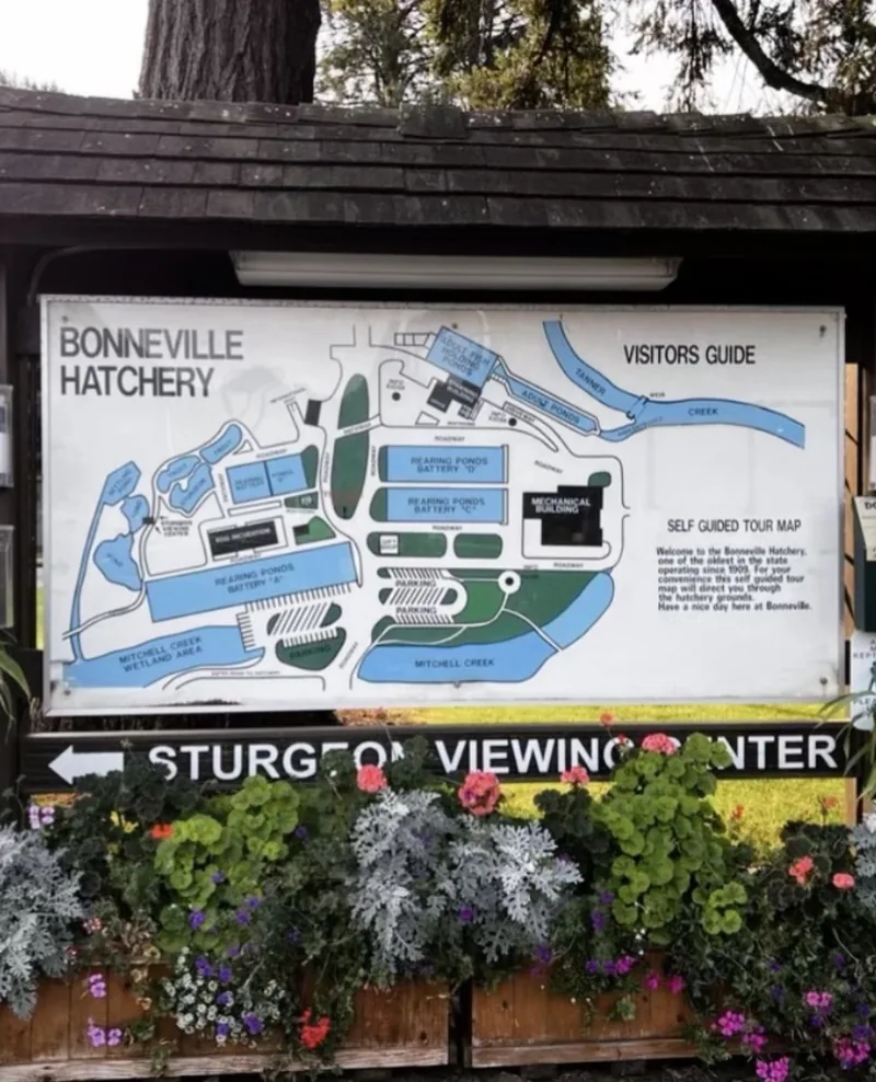
A self-guided tour map is displayed near the entrance. Visitors can explore the grounds in any order or follow the painted fish prints between major attractions.

Cost

Admission and parking are free. Bring quarters if you would like to purchase food for the rainbow trout.

Activities

Walk through the gardens, feed the trout, visit Herman and the smaller sturgeon, explore the interpretive displays, watch seasonal spawning activity, picnic beneath the trees, and browse the gift shop.

What to Bring:

Quarters for fish food, comfortable walking shoes, water, a camera, sun protection, and a light layer for the Gorge’s famously changeable weather.

Read Along the Route

Pair this walk with Tribal Histories of the Willamette Valley by David G. Lewis. Its Indigenous-centered history adds valuable context to the rivers, salmon, and communities that have shaped the region for thousands of years, encouraging a more thoughtful perspective on the waterways and fish programs encountered at Bonneville Hatchery.

FREE PRINTABLE GUIDE

Take the hatchery loop with you

Print or save this Bonneville Fish Hatchery walking map for an easy, family-friendly adventure through gardens, trout ponds, and the home of Herman the Sturgeon. It includes the suggested loop, key stops, accessibility details, and practical trail notes.

The Bonneville Fish Hatchery was meant to be a quick pit stop during our tour of the Columbia River Gorge.  

We planned to stretch our legs, look at a few fish, and continue down the highway. Then we saw the gardens.

Instead of the industrial setting we had imagined, we found broad lawns, flower-lined paths, tranquil ponds, and enormous trees casting pools of shade across the grounds. Roses in every shade of pink, red, peach, and cream filled the sunny beds. Daisies nodded above the greenery, while dahlias, geraniums, torch lilies, and purple verbena crowded the edges of a quiet pond. We immediately decided it was a beautiful spot to meander through.

There is no prescribed route through the hatchery, so we simply followed whichever path looked most inviting. The paved walkways curved beneath tall conifers, crossed small channels, and connected the gardens with the working hatchery buildings and display ponds. 

The rainbow trout ponds brought out our inner children. Large trout glided beneath reflections of branches and blue sky, then rushed toward the surface whenever someone dropped food into the water. Quarter-operated dispensers stand beside the ponds, and watching the trout churn around each handful was easily worth the loose change.

From there, we followed the signs to the little white Sturgeon Viewing and Interpretive Center. The pathway descended through a shady garden before leading us inside to meet the hatchery’s most celebrated resident.

Herman the Sturgeon is difficult to describe without sounding as though we are exaggerating. He is approximately ten feet long, weighs about 500 pounds, and is more than 80 years old. White sturgeon have existed in some form for roughly 200 million years, and Herman certainly looks the part. He moved slowly past the underwater window, his armored body and whisker-like barbels giving him the appearance of a creature from another age. Seeing him at eye level was both slightly eerie and completely fascinating. 


The viewing center also overlooks an outdoor pond containing smaller sturgeon and oversized trout. Interpretive displays explain how these ancient fish locate food and how the working hatchery supports Chinook salmon, coho salmon and steelhead programs throughout the Columbia River Basin.

Before leaving, we stopped at the gift shop, formerly known as Spruce Gifts & Provisions and now branded as the OWF Gift Shop. It carries local artwork, Columbia Gorge souvenirs, regional treats and fish- and wildlife-themed gifts, with purchases supporting the Oregon Wildlife Foundation’s conservation work. 

What began as a practical pit stop became one of the loveliest surprises of our Gorge tour. The walk is short, flat and unhurried.

But, between the brilliant gardens, peaceful water, darting trout and one unforgettable prehistoric fish, there is far more here than the distance suggests.

ONE PAGE AND STEP AT A TIME
“The guide spoke to Clark about the populations of Kalapuya peoples in a great valley whose waters were drained through a falls.”

David G. Lewis, Tribal Histories of the Willamette Valley 

04  |  Multnomah Falls Hike

HIKING GUIDE

The Postcard View
Is Only the Beginning

Trail at a Glance

TIME

~1.5 to 2 hours  
Roundtrip  

DIFFICULTY

Moderate
Steep with switchbacks  

DISTANCE

2.4 miles
Out & Back

ELEVATION

~830 feet
Approximate gain
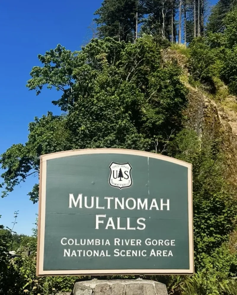
multnomah falls sign

Quick Trail Notes

Trailhead
Accessibility

The paved route from the parking area to the lower viewing plaza is wheelchair- and stroller-accessible. The climb toward Benson Bridge has a moderate grade and may require assistance. The steep trail beyond the bridge, including its switchbacks, uneven pavement and stairs, is not wheelchair-accessible.

Facilities

Multnomah Falls Lodge has a restaurant, espresso stand, gift shop and Forest Service visitor center. Restroom renovations are scheduled to continue through November 2026, with limited portable toilets available during the work.

Water Availability

Potable water and bottle-filling stations are available at the Lodge at the base. 

Cell Service

Coverage can be spotty around the falls and along the Waterfall Corridor. Download your map and permit before arriving.

Seasonal Closures

The site is generally open year-round, but ice, falling icicles, storms, maintenance or trail damage can temporarily close sections beyond Benson Bridge. Check current conditions before setting out.

Parking

The Main Lot: I-84 Exit 31 (Center Median) is the primary access point. From May 22 through September 7,, private vehicles using this lot between 9 a.m. and 6 p.m. require a timed-use permit. A permit does not guarantee a parking space. The small privately operated lot beside the Historic Columbia River Highway has limited paid parking; no Historic Highway timed-use permit is required in 2026. This lot strictly prohibits oversized vehicles, RVs, and trailers.

Dogs

Allowed on leash

Maps

Available via AllTrails. Physical, free trail maps are provided by the U.S. Forest Service inside the lodge visitor center.

Cost

Free to hike, but dynamic vehicle permits or fees apply depending on how you get there. Timed-Use Permits: Required for personal vehicles parking at the I-84 lot (Exit 31) during peak summer months only  (typically late May through early September).

Shuttles/Public Transit: If you utilize options like the Columbia Gorge Express bus or private tour shuttles, you bypass the vehicle permit requirement.

What to Bring:

Sturdy shoes with good traction, water, sun protection, and a waterproof layer for waterfall mist or changing Gorge weather. In freezing conditions, carry traction devices and confirm that the upper trail is open. A camera or phone for pictures.

Read Along the Route

Pair this hike with Passersthrough by Peter Rock. Its haunting Pacific Northwest forests and rivers echo the shadowed trails, rushing water, and mysterious beauty of the Columbia River Gorge, making it an atmospheric companion for the climb above Multnomah Falls.

FREE PRINTABLE GUIDE

Take the waterfall climb with you.

Print or save this Multnomah Falls hiking map before climbing from the historic lodge past Benson Bridge to the top-of-the-falls overlook. Keep the route, elevation profile, parking information, and essential trail notes handy for your hike.

Multnomah Falls was the pinnacle of our tour through the Columbia River Gorge and yes, it is every bit as impressive as the photographs suggest.  

We first saw the waterfall from the plaza beside the historic lodge. From there, the entire 620-foot cascade appeared between steep walls of dark basalt.  It included a slender upper fall plunging into a mossy basin, followed by the powerful lower drop. Benson Bridge curved across the gorge between the two tiers, looking almost impossibly delicate against the rock and rushing water.

The classic view is only a short walk from the lodge, but we wanted to see what waited above it. We followed the paved trail uphill toward Benson Bridge, passing beneath bigleaf maples and through dense walls of ferns and leafy vines. White trumpet-shaped flowers peeked from the greenery, and sunlight flashed through the canopy whenever the forest opened. As we stepped onto the bridge, cool mist drifted across the walkway and the upper falls thundered behind us. It was busy,  as this is Oregon’s most famous waterfall, after all,  but the setting still felt extraordinary.

Beyond the bridge, the real climb began. The trail gained roughly 830 feet through a steady procession of switchbacks. Although the route was paved, there were cracked and uneven sections so it is important for hikers to watch their footing.  Douglas firs towered overhead, sword ferns crowded the slopes, and weathered tree trunks reached into the bright blue sky. The forest occasionally parted to reveal rugged basalt outcrops and increasingly expansive glimpses of the Columbia River.
Those viewpoints became our excuse to stop and catch our breath. Far below, the lodge plaza disappeared into the trees while the river stretched broad and blue across the Gorge. Purple wildflowers were set along the sunnier sections of trail, a lovely contrast to the deep greens and dark volcanic rock surrounding us.


Near the top, we left the main switchbacks and followed the short spur toward the overlook above Multnomah Falls. The viewing platform is small, and the final approach includes steps, but it offers a fascinating perspective over the lip of the waterfall. We could watch Multnomah Creek gather itself and then vanish over the cliff, knowing the familiar postcard view was now hundreds of feet beneath us.

The return journey followed the same route downhill. This was easier on our lungs but harder on our knees, particularly where loose grit covered the pavement. Sturdy shoes were worth having.

Back at the base, we finished our visit with a meal and a cold drink inside Multnomah Falls Lodge. Built in 1925, the stone lodge passed its centennial in 2025 and remains a charming retreat to rest and reset after the hike. Its restaurant, gift shop, espresso stand, and Forest Service visitor center make this feel like much more than a roadside waterfall stop.

Multnomah Falls may be famous, crowded, and easy to reach but climbing beyond the postcard revealed the quieter forest, wildflowers, volcanic cliffs, and river views that made the experience even more memorable.
ONE PAGE AND STEP AT A TIME

“Only the voices, rushing through the branches of hidden trees.”

Peter Rock, Passersthrough

ORIGINAL WORK
THOUGHTFULLY RESEARCHED

Written by Jacqueline Miller, founder of Adventurous Ambles. Through firsthand travel, original photography, and detailed route research, Jacqueline creates walking guides, hiking resources, destination reading lists, and travel inspiration for curious travelers. Unless otherwise noted, all content and photography on Adventurous Ambles are original works protected by copyright.


KEEP WANDERING

More Adventurous Ambles in Portland

DESTINATION GUIDE

Your Practical Guide to Exploring Portland
Portland, Oregon, US
Visitor Information, Packing List, FAQs

READING LIST

The Stories Behind the City of Roses
Portland, Oregon, US
Destination Reads

CITY WALK

Books, Brews, & One Surprise Llama

Downtown Portland & the Pearl District, Oregon, US

Neighborhood Stroll, Shops, Eateries
Scroll to Top