DESERT ROADS, WILD COASTS & TWO SEAS
Baja California Peninsula
and sunlit coastlines between the Pacific Ocean and the Sea of Cortez.
BAJA CALIFORNIA PENINSULA TRAVEL GUIDE
Two Seas.
One Remarkable
Peninsula
A Brief History of the Baja California Peninsula
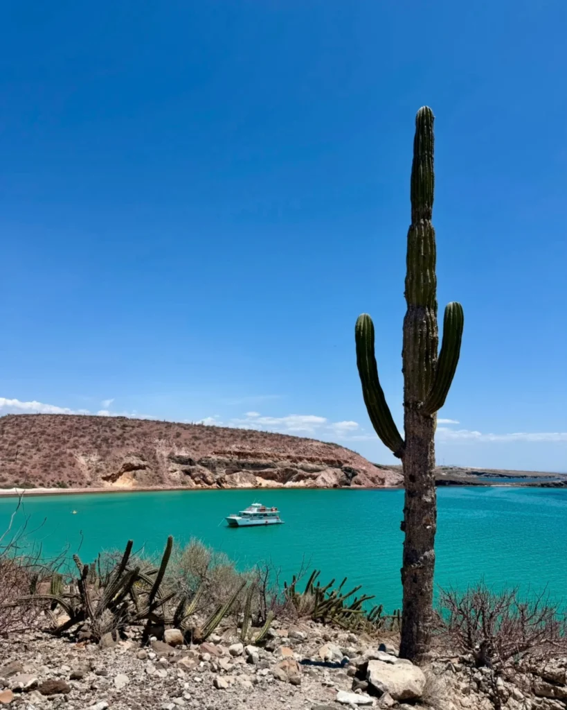
The Baja California Peninsula feels like it was designed for travelers who prefer the long way around. A single ribbon of highway runs between rugged mountains, enormous cactus forests, fishing villages, historic missions, and coastlines that seem to stretch forever.
Long before modern borders divided the peninsula, Indigenous peoples, including the Kumeyaay, Cucapá, Paipai, Kiliwa, Cochimí, Guaycura, and Pericú, lived throughout the region. Their knowledge of the desert, mountains, water sources, and seasonal landscapes shaped life here for thousands of years.
Spanish missionaries established settlements across the peninsula beginning in the late 1600s. The mission route eventually extended north into present-day California, leaving historic churches and portions of El Camino Real throughout Baja.
Today, the peninsula comprises two Mexican states: Baja California in the north and Baja California Sur in the south. Together, they offer an extraordinary mix of border culture, wine country, desert wilderness, marine habitats, artistic communities, and outdoor adventures.
For walkers, road-trippers, readers, and curious travelers, Baja is not simply a destination. It is a journey between two seas.
What to Know
Before You Go
Baja rewards travelers who leave room for the unexpected.
Distances are longer than they appear, desert temperatures can change quickly, and some of the peninsula’s most memorable places are found far beyond its resort towns.
01 | ARRIVAL
Visas & Entry
U.S. citizens generally do not need a tourist visa for visits of up to 180 days. However, Mexican immigration officials determine the authorized length of each stay.
Travelers arriving by air need a valid passport book. Those entering at a land border can generally use a passport book or passport card. Travelers entering by land may also need a Forma Migratoria Múltiple, commonly called an FMM.
At international airports, immigration information is generated digitally rather than through a paper FMM. Keep your passport, accommodation details, return plans, and immigration records accessible throughout the trip. Mexico’s National Immigration Institute explains the current air and land procedures.
International visitors to Baja California Sur who are over age 12 and stay longer than 24 hours should also review the state’s current Embrace It visitor contribution. Requirements and fees can change, so verify the amount before traveling.
02 | WHEN TO GO
Best Time to
Visit
October through April generally brings the most comfortable weather for exploring the Baja California Peninsula. Days are pleasant for walking, hiking, and road-tripping, although desert nights and northern mountain areas can become surprisingly cold.
Late spring and summer bring warmer water and fewer visitors, but temperatures can become extreme inland and along the Sea of Cortez. Tropical storms are also possible from summer into fall.
October – April
October – May
Cooler weather for Tijuana, Ensenada, Valle de Guadalupe, and mountain hikes.
November – April
Sunny days for La Paz, Todos Santos, Loreto, and Los Cabos.
January – March
Peak season for gray whales in the Pacific lagoons and humpbacks near Los Cabos.
Gray whales typically reach Baja’s protected Pacific lagoons from late December or early January through April, with February and March often delivering the strongest viewing opportunities.
Weather & Seasonal planning
Mexico National Weather Service ↗
National Hurricane Center ↗
03 | IN YOUR BAG
What to Pack
Packing for Baja means preparing for sunshine, wind, cool desert evenings, and days that may move between city streets, rocky trails, and the water.
✓ Comfortable walking shoes
✓ Hiking shoes with good traction
✓ Lightweight, breathable clothing
✓ Sweater or fleece for cool evenings
✓ Lightweight windbreaker or rain jacket
✓ Sun hat, sunglasses, and reef-conscious sunscreen
✓ Swimsuit and quick-drying towel
✓ Refillable water bottle with plenty of backup water
✓ Small daypack for trails and day trips
✓ Insect repellent
✓ Portable phone charger
✓ Basic first-aid supplies
✓ Offline maps for remote areas
✓ Mexican pesos in small denominations
✓ Warmer layers for winter nights and mountain destinations
Mexico uses Type A and Type B electrical outlets, the same types commonly used in the United States and Canada.
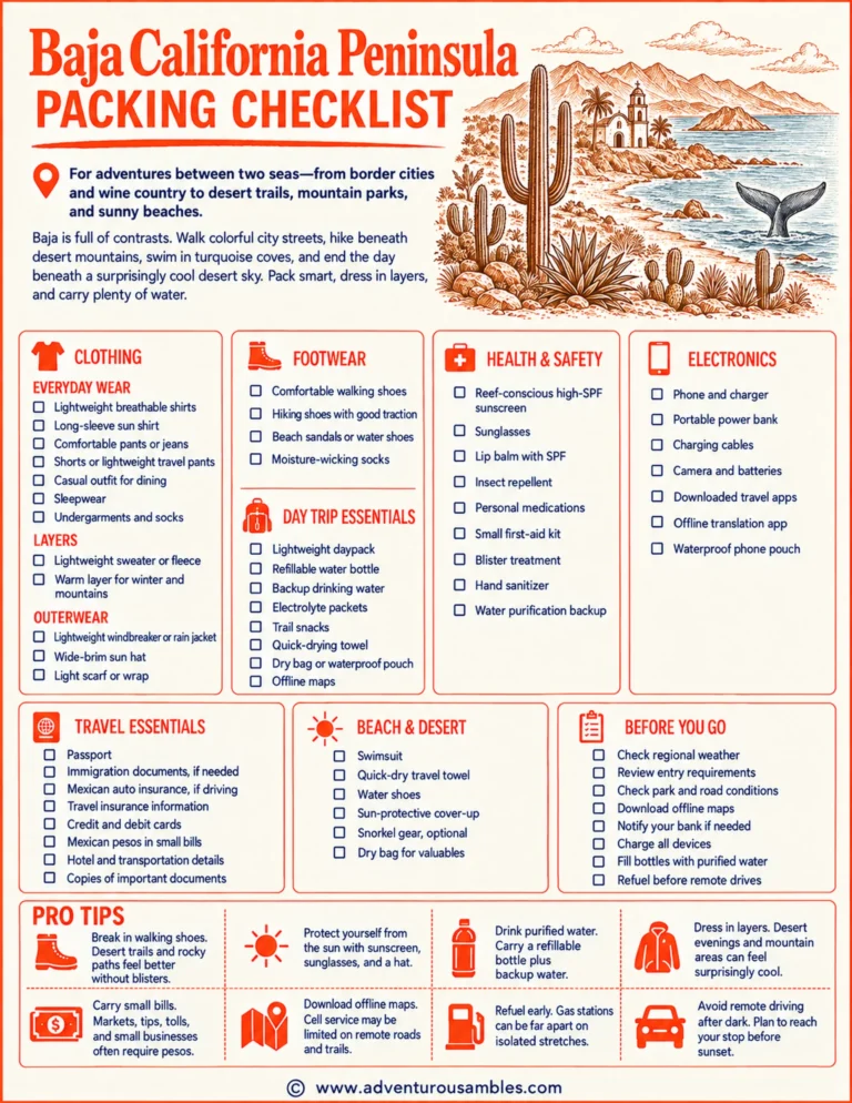
Save or print this Baja California Peninsula packing checklist to prepare for city walks, desert trails, mountain adventures, sunny beaches, and freshwater swimming.
04 | BUDGET
Average Costs
The cost of a Baja trip depends heavily on whether you are planning a simple road trip, a boutique coastal escape, or a resort stay in Los Cabos.
~ $300–$700
Round-trip economy, depending on departure city and season.
Round-trip economy, with fewer direct routes from many cities.
per night
per night
per night
Per night, with premium properties costing considerably more.
Northern Baja can be explored affordably by flying or driving to San Diego and crossing the border. Los Cabos usually has the widest selection of flights but also some of the peninsula’s highest hotel prices. La Paz, Loreto, Ensenada, and smaller communities often provide a broader mix of locally owned accommodations.
Current rates vary dramatically by destination and season; recent searches show northern Baja hotels averaging around $125 per night, while La Paz ranges from inexpensive local properties to luxury stays above $400.
Compare flights & stays
05 | ON THE MOVE
Getting
around
Baja
The journey becomes part of the adventure.
Driving offers the most freedom for reaching remote beaches, desert landscapes, national parks, and smaller communities. Highway 1 connects Tijuana with Cabo San Lucas, but long distances and limited services require planning. Carry water, download offline maps, refuel before remote stretches, avoid driving after dark, and purchase valid Mexican automobile liability insurance.
Flying can save considerable time between the northern and southern peninsula.
Major airports include Tijuana, Los Cabos, La Paz, and Mexicali. Loreto also receives a smaller selection of international and domestic flights.
Long-distance buses connect larger communities along the peninsula. Services vary by region, and remote beaches, trailheads, vineyards, and mountain areas may still require a car, taxi, or tour.
Taxis and rideshare services are useful in Tijuana, Ensenada, La Paz, and Los Cabos. Airport rules and availability vary, so confirm the pickup location and estimated fare before traveling.
Passenger and vehicle ferries connect the La Paz area with Mazatlán and Topolobampo on mainland Mexico. This is particularly useful for travelers incorporating Baja into a longer Mexican road trip. La Paz tourism lists both passenger routes.
06 | THE BEST WAY
On foot
Walk through Tijuana’s cultural districts, follow an official trail into northern Baja’s mountains, or explore extinct volcanic landscapes near San Quintín. Farther south, wander around Loreto’s mission, follow the La Paz waterfront, hike between desert cliffs and turquoise water, or descend through a rocky canyon to a freshwater pool.
The peninsula’s distances may call for a car, but its details are best appreciated slowly: weathered missions, enormous cardón cacti, tide pools, colorful galleries, fishing boats, and desert mountains glowing in the final light of day.

USEFUL LINKS
Walks, trails &
destinations
San José del Cabo Art Walk ↗
Balandra Protected Area ↗
Cañón de la Zorra & Sol de Mayo ↗
07 | QUICK BASICS
Currency, language & time zone
CURRENCY
Baja uses the Mexican peso, abbreviated MXN and commonly shown with the $ symbol.
Cards are widely accepted at hotels, resorts, restaurants, and larger businesses. Carry pesos for tolls, markets, tips, small restaurants, remote communities, and businesses without reliable card service.
LANGUAGE
Spanish is the primary language throughout the peninsula. English is common in border communities and major tourism areas, although a few Spanish phrases are helpful everywhere.
Indigenous languages and cultural traditions remain important, particularly among Kumeyaay, Cucapá, Paipai, Kiliwa, and Cochimí communities.
TIME ZONE
The peninsula uses two time zones.
Baja California, including Tijuana and Ensenada, follows Pacific Time and observes seasonal clock changes. Baja California Sur, including La Paz, Loreto, Todos Santos, and Los Cabos, follows Mountain Standard Time throughout the year without seasonal clock changes. Because the two states follow different daylight-saving rules, they may show the same time during part of the year and differ by one hour during another. Check the local time when crossing the state line.
Local essentials
Mexican Peso↗
Spanish App ↗
08 | GOOD TO KNOW
Frequently Asked Questions
What is the best time to visit Baja California?
October through April generally offers the best conditions for walking, hiking, sightseeing, and road-tripping. Northern Baja can be cool and occasionally rainy in winter, while southern Baja usually remains sunny and mild.
January through March is especially appealing for whale watching. Summer can be extremely hot inland and along the Sea of Cortez.
Where is the best place to see whales in Baja California?
Gray whales gather in the protected Pacific lagoons around Guerrero Negro, San Ignacio, and Magdalena Bay, usually from January through March. Humpback whales are commonly seen near Los Cabos, while blue whales visit the waters around Loreto.
Is the Baja California Peninsula safe to visit?
Conditions vary between the two states, cities, highways, and rural areas. Review the current U.S. State Department advisory for both Baja California and Baja California Sur rather than treating the entire peninsula as having identical conditions.
Use established roads, avoid remote nighttime driving, keep valuables out of sight, and follow current local guidance. Review the current state-by-state advisory.
Can I explore both Baja California and Baja California Sur in one trip?
Yes, but the peninsula is much larger than it appears. Highway 1 stretches from Tijuana to Cabo San Lucas, with long distances between some communities. Flying between northern and southern Baja is best for shorter trips, while a full road trip requires at least two weeks for a comfortable pace.
Can you drink the tap water in Baja?
Travelers should generally drink bottled, filtered, or properly purified water. Many hotels and established restaurants provide purified water and use it for drinks and ice.
Carry extra drinking water when driving or hiking in remote areas. Distances between reliable water sources can be considerable.
Follow the highway beyond the familiar. Walk through a quiet mission courtyard, climb a cactus-covered hillside, cool off beneath a freshwater waterfall, or stay beside the sea until the desert turns gold.
Leave room for long distances, unexpected stops, and the kind of places that make you wonder why you ever planned to hurry.
THOUGHTFULLY RESEARCHED
Written by Jacqueline Miller, founder of Adventurous Ambles. Through firsthand travel, original photography, and detailed route research, Jacqueline creates walking guides, hiking resources, destination reading lists, and travel inspiration for curious travelers. Unless otherwise noted, all content and photography on Adventurous Ambles are original works protected by copyright.
KEEP WANDERING
More Adventurous Ambles in Baja California

READING LIST